American Journal of Environmental Engineering

p-ISSN: 2166-4633    e-ISSN: 2166-465X

2016;  6(3): 73-87

doi:10.5923/j.ajee.20160603.01


Urban Design and Social Livability: The Revitalization of the Corniche in Doha

Raffaello Furlan

College of Engineering, Department of Architecture and Urban Planning, Qatar University, Doha, State of Qatar

Correspondence to: Raffaello Furlan, College of Engineering, Department of Architecture and Urban Planning, Qatar University, Doha, State of Qatar.

Email:

Copyright © 2016 Scientific & Academic Publishing. All Rights Reserved.

This work is licensed under the Creative Commons Attribution International License (CC BY).
http://creativecommons.org/licenses/by/4.0/

Abstract

The 1940s discovery of oil in Qatar caused a change from fishing and pearling based to a multifaceted economy. Through past few decades Qatar has experienced a rapid growth, which has radically influenced the country’s physical, economic, cultural and demographical status. In addition, Qatar has planned to invest large funds over the next five years on the development of the built environment of Doha’s metropolitan area. The aim of this paper is exploring how and the extent to which the public realm and spine of Doha represented by the Corniche (1) encourages the formation of enhanced levels of social and community interactions (i.e., social life) and (2) can be implemented in order to further enhance social interactions and/or livability. The study investigates the extent to which the public realm of the Corniche can be revitalized in order to enhance users’ levels of social interactions. In order to reply to the main question, the system of social activities performed by the users within the selected area is explored and analyzed through data obtained from (A) users’ interviews, survey and (B) visual material. The analysis indicates that (1) the Corniche encourages people to be socially engaged and enhance higher level of social life. (2) Furthermore, the study allows understanding of how this public open space setting should be implemented in order to encourage social activities.

Keywords: Sustainable Urbanism, Open Public Realm, Community Engagement, Human Behavior, Social interactions

Cite this paper: Raffaello Furlan, Urban Design and Social Livability: The Revitalization of the Corniche in Doha, American Journal of Environmental Engineering, Vol. 6 No. 3, 2016, pp. 73-87. doi: 10.5923/j.ajee.20160603.01.

1. Background

The State of Qatar is a peninsula situated in the Persian Gulf (Fig.1). Qatar, connected to Saudi Arabia (land boarder), is part of the Gulf Co-operation Council (GCC) Region, which was founded in 1981. The GCC includes six Gulf countries: Kuwait, Bahrain, Qatar, United Arabs Emirates, Oman and Saudi Arabia. The purpose of the GCC is to unify regional foreign policies and support common multifaceted interests.
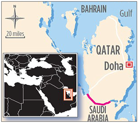
Figure 1. The State of Qatar
Qatar was a nation characterized by fishing villages near the Gulf and farms located in spread areas where there were water sources available [1]. Its economy relied on trading activities. It was the discovery of natural oil and gas resources in 1939, which caused a rapid change from an economy based on fishing and pearling to multifaceted one [2-5].
The 1960-1970s oil incomes contributed to the booming in the regional real-estate and namely to the radical development of the built environment of its capital city, Doha [3, 6, 7]. As a result, in the past few decades the State of Qatar has experienced an extraordinary urban growth that has affected the country’s economic and demographical status [8]. Urban planning in Qatar started at the beginning of the 1970s and intended to produce objectives and standards with the ultimate aim to move forward within a framework for developing the country [9, 10].
In this period, the profit from extensive oil trading was allocated to fund major urban developments for modernizing Doha, particularly with planning large projects hosting ministries and other government buildings. One of the major and most significant urban reclamation areas is known as West bay, the New Business District of Doha comprising the areas of Al Corniche and Al Dafna. In 1972 the British planning firm Llewellyn-Davies was appointed to design and plan the development of the urban area. The urban planner proposed to decentralize urban areas within Doha’s ‘A ring’ (i.e. the old city center) through a demolition program in order to allocate roads and infrastructures. Concurrently, it was planned to reclaim the shallow waters within the north of Doha and to locate major government buildings (ministries) and financial buildings (bank-headquarters). Afterwards, the American firm Pereira Architects designed the new waterfront of Doha with the currently existing characteristic convex-like profile. The waterfront/promenade of Doha, also known today as Al Corniche [11, 12], was formed as result of extensive dredging work carried out in the late 70s with the purpose to reshape Doha’s coastline.
In 2009 the Ministry of Municipality and Urban Planning (MMUP) developed the Qatar National Master Plan (QNMP), in accordance with the Government objectives for the urban development of the country, providing the strategy for the urban planning and development management for Qatar, with a planning horizon to 2032 (Fig.2). QNMP is considered the physical tool for realizing the Qatar National Vision (QNV 2030), which was prepared by the General Secretariat for Development Planning. The vision lays the foundation for Qatar’s long-term development strategy, based on the four pillars of sustainable growth: Human, Social, Economic and Environmental Development.
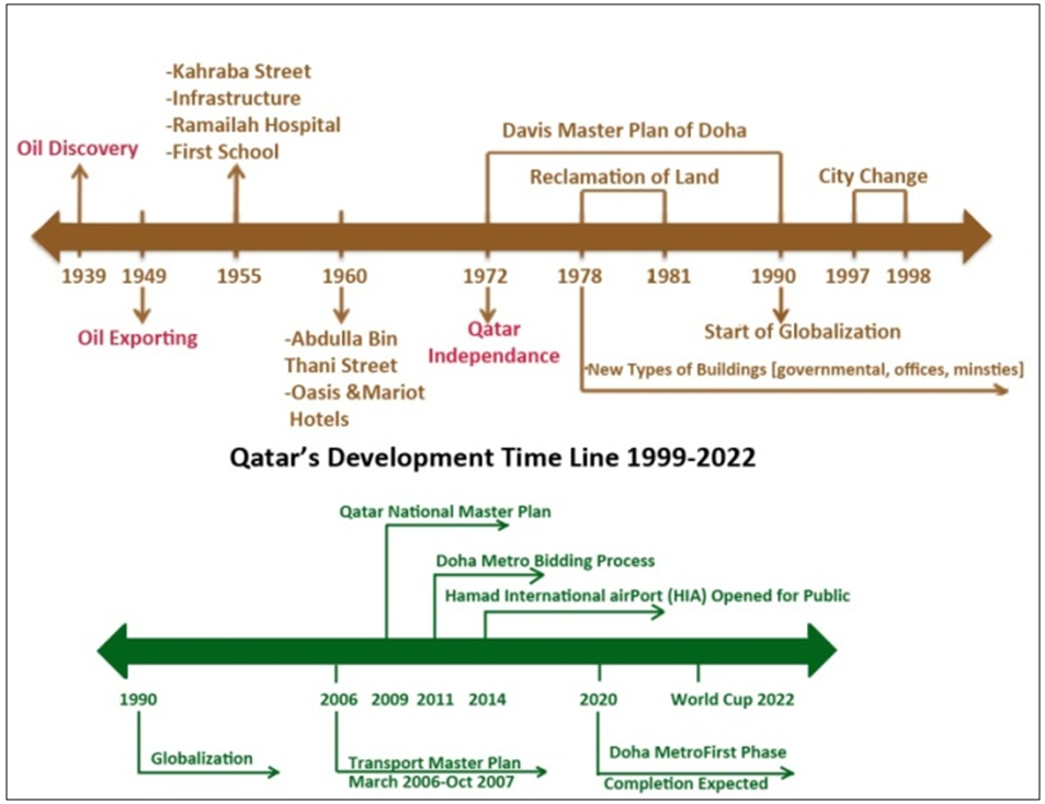
Figure 2. Qatar’s development time line 1999-2022
QNMP is inclusive of the Qatar National Development Framework (QNDF), which defines place making strategies, Municipal Spatial Development Plans (MSDPs), Action Area Plans for key sites such as West Bay, cardinal Downtown Doha zones, Al Rayyan South Metropolitan Centre and town centre plans. QNDF promotes development models such as Compact Cities, Transit Oriented Development, Traditional Neighbourhoods, and Livable Cities. These models are considered tools to manage sustainable growth, to provide economic vitality and finally to develop livable and sustainable communities. More specifically, the identified key elements of the QNDF Spatial Strategy are the following:
• Establishment of urban growth boundaries to limit urban sprawl;
• More compact city structure based on urban consolidation and mixed-use centers;
• A hierarchy of Centers – land uses clustered in Capital City Centers, Metropolitan Centers; Town Centers and local/neighbourhood centers;
• Creation of mixed-use Transit Oriented communities on key public transport nodes to boost economic and retail activity, and reduce traffic congestion;
• Move away from a roads-dominated transport system to more public transport;
• Focus on place-making and unique place identity;
• Address specific Qatari housing needs and preferences;
• Adopt more traditional and climatically suitable architectural design.
The following are the major spatial development challenges:
• Managing population growth and demographic change;
• Building strong and self-sufficient communities;
• Reversing environmental degradation and depletion of resources;
• Managing unconstrained and fragmented land development and over-supply;
• More effective supply/demand management and use of land and vacant areas;
• Connecting land-use and transportation, reducing congestion;
• Delivering appropriate and timely investment in infrastructure;
• Improving access to health, education and other community facilities;
• Dealing with isolated and disconnected large single-purpose land uses.
Critical to the physical realization of the planning policies developed within the Qatar National Development Framework was the implementation of area action plans across the country. These active strategies aimed at regenerating high profile areas of the country including Downtown Doha and the financial district of West Bay [13]. All areas were undergoing dramatic change and pressure for growth, aided by new public transit infrastructure. Within Downtown Doha, comprehensive renewal plans were developed that aimed at reversing the decline of streets, buildings and open spaces.
According to researchers and scholars, among the most neglected realms in town planning are neighbourhood parks and plazas, which greatly enhance the quality of neighbourhood life [14-18]. Pedestrian network outfitted with benches and playground equipment can allow recurring casual social interactions. Parks and plazas with a high degree of landscaping, water features and facilities play a key role in creating a livable space. Conversely, unpleasant characteristics of outdoor spaces can deter people from staying outdoors and/or strengthening the tendency to be indoors. This paper focuses on the public open space represented by Doha’s Corniche, the several kilometres’ waterfront promenade along Doha Bay, ranging from West Bay (North) to the Museum of Islamic Art (South) (Fig.3-4).
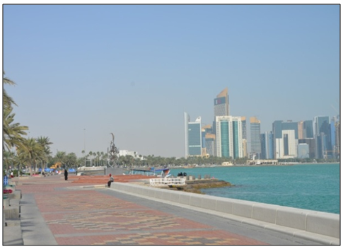
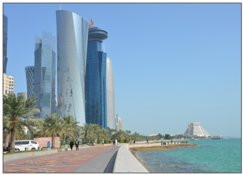
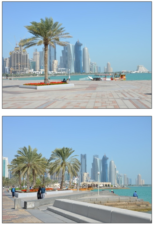
Figure 3. The Corniche Doha in proximity of West Bay
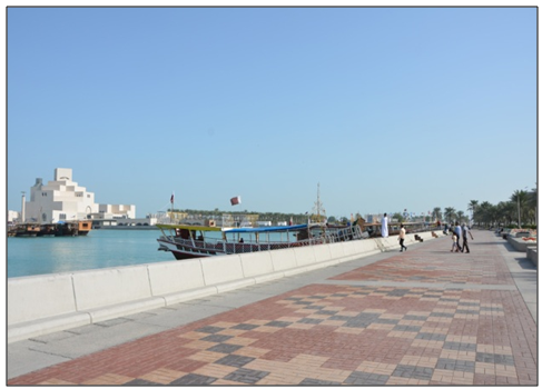
Figure 4. The Corniche in proximity of the Museum of Islamic Art
The Corniche is a linear link with other radial connectors (previously also defined as ‘the great connector’ and ‘grand curve’), which connects West Bay (‘New Doha’) to the Souq Waqif (’Old Doha’). It is a waterfront promenade, which runs for several kilometers along Doha Bay and provides a wonderful view of the bay. The curve of the Corniche is the identifying motif of Doha: it celebrates the dialogue between new and old and between the land and the sea across the space of the bay. The dialogue established by the Corniche is essential to the identity of the city. This embracing open public space is interpreted as the ‘Urban Majlis’, the great gathering place, which holds the city together [19].
Regardless of the interest to the relationship between livability and public realm, direct assessment of the extent to which likability can be enhanced within the Corniche in Doha has not been investigated yet. Therefore, this study intends to investigate how and the extent to which the open public space and/or setting of the Corniche can be implemented in order to enhance livability. The paper argues that the current location, spatial form and/or setting of the Corniche facilitate the formation of social activities and that livability can be implemented through the implementaion of specific physical elements.
Sustainable Urbanism: The Integration of Built and Natural Environment
Scholars and researchers argued that most urban designers and planners have viewed natural forces as apart from the city, where cities have failed to use the full potential of nature in creating healthy, economical, livable and pleasant urban environments. Therefore they stress the importance of considering nature along the urban design of cities: the form and appearance of the city should be profoundly transformed by inserting plants, especially trees, vegetation and green areas. This would have an impact far beyond beautification: benefits would extend to the function of such areas, namely to sustainability aspects [15, 20-28].
Nowadays the term ‘sustainability’ is extensively adopted: the urban form is a cardinal characteristic of the challenge of sustainability. This implies that when designing for sustainability, practitioners must move beyond the micro-scale of buildings: they must look at the macro-scale, at the built environment of the city. Scholars and researchers stress scientific concern about current practices not being sustainable: they urge the need to reform such practices, in order to avoid critical ecological (climate change), social and economic consequences in the next future. This vision or premonition contributed to the birth of a movement defined as sustainable urbanism [21].
Sustainable urbanism uses knowledge of human and natural systems to integrate walkable and transit-served urbanism with high-performance buildings and high-performance infrastructure [29].
Sustainable urbanism embodies a generational change in the way human settlements are planned and built. It advocates strategies to develop the spatial form of the settlement, which in turn influences users’ lifestyle. The movement aims at redesigning the built environment in a manner that promotes a sustainable and healthy lifestyle. The foundations for the movement are drawn upon the theory of urbanism -the human settlements- with the contemporary environmentalism, and namely on the role of nature on human settlements. In the past century the design of cities neglected to improve urban settlements by better integrating the built environment with the natural environment. Sustainable urbanism, aiming at highlighting the benefits of integrating built and natural systems, grows out of past century three main reform movements: (1) Smart Growth, (2) New Urbanism and (3) Green Building. Sustainable urbanism’s target is to forge these three important movements into a comprehensive design philosophy in order to create sustainable human environments.
(1) The Smart Growth Movement is based on the development of ten principles for urban growth. At that moment, several environmentalists were simply anti-growth and viewed all development as antagonistic to the environment. The principles, shared by a decentralized public movement of citizen activists and practitioners, are the following:
• Create a range of housing opportunities and choices;
• Create a walkable neighborhood;
• Encourage Community and Stakeholder Collaboration;
• Foster Distinctive, attractive places with a strong sense of place;
• Make development decisions predictable, fair, and cost-effective;
• Mix land users;
• Preserve open space, farmland, natural beauty, and critical environmental areas;
• Provide a variety of transportation choices;
• Strengthen and direct development toward existing communities;
• Take advantage of compact building design.
(2) The aim of the New Urbanism Movement (CNU) is to encourage traditional urbanism as a strategy to minimize urban sprawls. The movement focuses at forming mixed-use neighbourhoods and transit villages and/or oriented developments (TODs), featuring town centers characterized by pedestrian networks, and surrounded by traditional buildings.
(3) The United States Green Building Council (USGBC) started in Washington in the early 1990s with the aim to draft pioneering standards for green building. The term LEED, which stands for ‘Leadership in Energy and Environmental Design’ was embraced in the late 1990s, when the rating system was at first launched.
The LEED standard combines prerequisites, with optional credits that earn points towards an overall score. As a project’s point score goes up it earns LEED certification at increasing levels of performance. USGBC set an initial target of certifying 5 percent of the US market for new construction buildings as green buildings under its LEED program [21].
In addition, USGBC sustains that the strategy for designing buildings should be based on integrated multi-faceted design, with the aim to maximize overall building performance without the addition of construction cost. In conclusion, accordingly to the Brundtland Commission (known as the World Commission on Environment and Development, convened by the United Nations in 1983), was formed for addressing growing concern "about the accelerating deterioration of the human environment and natural resources and the consequences of that deterioration for economic and social development", "Sustainable development is development that meets the needs of the present without compromising the ability of future generations to meet their own needs. It contains within it two key concepts: the concept of 'needs', in particular the essential needs of the world's poor, to which overriding priority should be given; and the idea of limitations imposed by the state of technology and social organization on the environment's ability to meet present and future needs" [30].
This means that nowadays there is a need (1) to have urban developments guided by sustainable planning and management vision; (2) to encourage policymakers, practitioners and developers to support sustainable site planning and construction techniques in order to reduce pollution and/or create a balance between natural and built systems; (3) to establish partnerships to create sustainable and livable communities and also preserve those with historic, cultural, and environmental resources; (4) to develop streets network and a multi-modal transportation system, (5) to create mixed-use developments providing mobility options and helping reduce pollution by reducing vehicle trips; (5) and finally to create interconnected green spaces, walking, bicycling and other mobility options networks easily accessed within the neighbourhoods [31, 32]. The Corniche promenade is vital to the city of Doha and its residents. It has to be preserved and furthermore enhanced in order for its spatial form and setting to enhance livability.
Livable Social Urban Spaces
Public Space is the playground of society; the public realm is the playground in which society reinvents itself [14].
Scholars argue that only a multifaceted and/or integrated approach including design and management can lead to creating and maintaining successful public spaces [17, 18, 33]. ‘Social urban spaces’ refer to public sites, which are commonly squares, or piazzas, where people usually gather and get involved in a series of social activities [34]. Without such spaces, the built environment of cities and towns would be made of mere masses of buildings and unable to offer opportunities for casual encounters and/or social interactions among people.
Also, it is argued that such public open spaces are arenas in which people can socialize, accept difference and learn understanding other people culture and/or way of life. Due to speculation and lacking of adequate urban planning policies, scholars and practitioners stress that the urban design of many urban contemporary developments neglects the insertion of public open urban spaces within the built environment [35]. The design of neighbourhood is often based on the delivery of the basic functional requirements of shelter and work. Spaces for leisure and social interaction are often not planned.
Scholars claim that Europe has the longest history and most sophisticated knowledge of designed public spaces (from classical Greece and the Roman Empire onwards). Since the ancient Greek agora, open public places have been at the heart of civilized urban life. Accordingly to researchers and scholars, urban public open spaces have huge social, political and economic value and finally the extent to which any town contains liveable open spaces is a reflection of civilization [36-38]. There are several benefits from having public spaces within the built environment of the city. The most common among them are (A) health and wellbeing, (B) learning, (C) tolerance, (D) solidarity and (E) economic. Urban open public spaces can obviously offer health benefits, being open spaces the most common arena for residents and workers to get fresh air, exercise in them and reduce sedentary lifestyle. Therefore, open spaces are important for users’ mental and physical health [28]. These spaces can also offer considerable social learning opportunities since they are universally accessible: people are facilitated to directly encounter other people with different cultures and habits. Open spaces can also offer opportunities to build up a sense of solidarity among fellow citizens, through meetings and organized events such as festivals and demonstrations [39-44]. Financial benefits can derive from sales of refreshments, stopping by at shops and cafes. In turn these facilities located in open spaces along popular attractions attract residents, tourists and visitors. In addition, scholars stress that well-used livable places are the alternative to downtown abandoned to socially rejected areas, which make people feel very unsafe. People tend to use or avoid urban public spaces accordingly to their level of safety. Open spaces can help to build a sense of community [45, 46]. According to scholars, ‘comfort’ opportunities are also crucial to making a place popular and/or livable. Comfort is mainly reached by providing appropriate areas or spaces in which to meet, sit, eat, drink and/or converse. Natural elements in the landscape can also contribute to make people feel comforted. Experiences of change in nature, such as the feel of the warm breeze, may cause delight and pleasure. This natural elements can experienced visually, and also through hearing and touch [29].
Doha’s Corniche: Accessibility and Regeneration of the Public Realm of the City
The Corniche is composed of a narrow pedestrian strip, extending about 7.5 kilometres along Doha Bay from the Sheraton Hotel at the north end to the Marriott Hotel at the South, past Dhow Harbour and Doha Port facilities. A belt of prestigious administrative, cultural and commercial facilities and parks lines the Al Corniche road, a dual carriageway running parallel to the pedestrian strip [47].
Doha’s Corniche is a waterfront promenade extending for several kilometres along Doha Bay. Running parallel to the Corniche is the Corniche Street, which connects the business district of West Bay with the south of the city. It comprises the Al Corniche road, a vehicular artery running parallel to the waterfront with a narrow strip of green area and a walkway. The Corniche was shaped as a result of intensive dredging work occurred between the late 1970s and early 1980s which finally remodelled Doha's coastline (Fig. 5-6).
Doha Corniche is defined as the coastal strip from the Sheraton Hotel to Doha Port and its interface with the area of Doha Bay containing Palm Tree Island. The Corniche is built on land reclaimed from the sea and is the result of the recent planning strategies that have transformed the dense urban fabric and intricate circulation system of old Doha on the south of the bay [12].
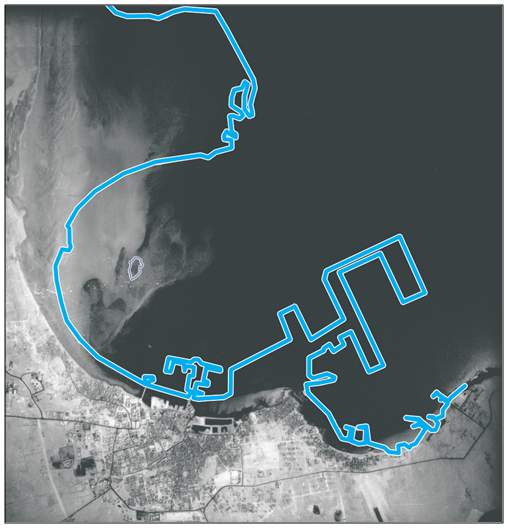
Figure 5. Doha in 1956 (Waterline in 2003) [47]
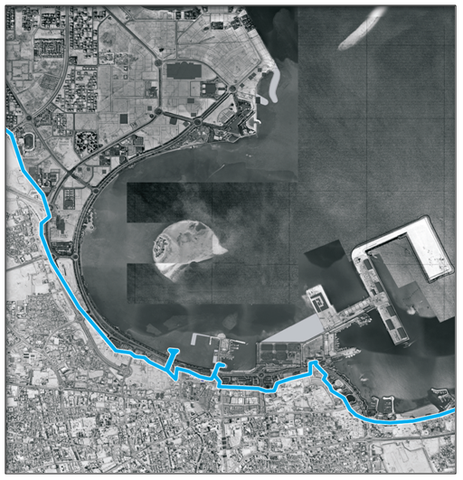
Figure 6. Doha in 2003 (Waterline in 1956) [47]
Conceptually the Corniche is a space for vehicular and pedestrian circulation, a continuous belt of open spaces, and, most significantly, a public real open to all people of Qatar. In this context the pedestrian Corniche is a precious asset, since it is the longest uninterrupted public realm in the city (Fig. 7-8). The Corniche is today a popular location among walkers, joggers and bikers. It is also used for the celebration of festivals like the Qatari National day and the sports day.
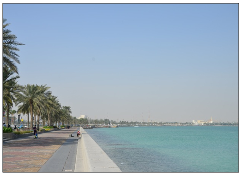
Figure 7. A view towards North side
Figure 8. A view towards South side
As mentioned, through the effect of landfill policies over recent decades Doha Corniche now forms almost a complete circle, and this influence the macro-form of Doha city. While old Doha, located on the south bank of the Corniche, originally had an intricate circulation system, the semicircular shape of the coastline has given rise to a new planning approach that has created a transport network of parallel ring roads and radical arteries. This has almost totally transformed the old fabric: the pedestrian network now forms circulation for private cars, the only public vehicles being taxis. As a consequence of these policies, the pedestrian Corniche is the city’s largest public space [48]. In addition, planning policies have encouraged the shift towards the northern and western corridors through the creation of prestigious urban facilities, the development of a new central business district, the construction of the City Centre shopping mall, and the relocation of large firms and government agencies.
The regeneration process is intended to enhance the quality of urban living along the Corniche and provide an international culture and arts identity though innovative, culturally appropriate and environmentally sensitive urban planning and landscaping, highlighted by selected landmark projects of international significance [47].
Doha hosts several green areas and parks that offer recreation and relaxation for walkers, joggers and families. From the shaped Corniche to the 88 hectare Aspire Park, visitors will find a spot to relax. Doha's famous 8 km-long waterfront Corniche offers panoramic views of the capital and a destination to have a walk. Lined with palm trees, the Corniche promenade is spectacular at night, when the shining lights of Doha’s iconic skyline are visible across Doha Bay, from the Museum of Islamic Art to the new business district of West Bay [19].
The Corniche is well defined by the waterline along one side but along the other the relationship between the city and the Corniche displays a lack of coherence. Although it is accessible by vehicle, government and business buildings form a barricade to pedestrians along parts of the urban edge of the Corniche [49]. This is exacerbated by the Al Corniche and Majilis Al Taawon ring road, which are high-capacity arterials that serve as expressways. Pedestrian radial movement towards the Corniche will increasingly clash with expanding vehicular traffic.

2. Methodology

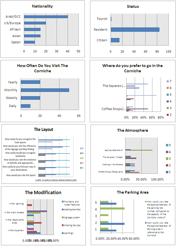
The study addresses the case of the Corniche open public realm in Doha, namely how and the extent to which the urban setting can be implemented for the enhancement of social interactions and/or activities. The Corniche is characterized by a distinctive open space, which is the arena for human activity (functional use). Therefore, the study aims at exploring (1) the spatial form, the setting and (2) the use of the open public space of the Corniche. This investigation involves analyzing the activities performed within (A) the public open space of the site. The analysis of the form and use of the Corniche is undertaken using six methods of investigation: (A) cartographic sources; (B) historic maps (the process of formation and transformation is deduced from their comparison); (C) photographs; (D) site observation of users’ activities, (E) on-site survey and (F) interviews conducted with 50 users [50-53]. While the first three methods investigate the extent to which the settlement facilitates social interactions, the last three explore the nature of social activities performed by the users (Appendix-figure 10-17). In relation to the concept of activities, as Rapoport highlights, it is crucial to dismantle the concept of activities into its variables, in order to understand the level of social interactions within the built environment. Rapoport identifies six components, which, in his theories, represent the system of activities. He highlights the variability of the activity which involves (A) the nature of the activity itself (what), (B) the persons involved or excluded (who), (C) the place where it is performed (where), (D) the order or sequence it occurs (when), (E) the association to other activities (how - including or excluding whom), and finally (F) the meaning of the activity (why) (54-58). Therefore the site observation, the survey and the interviews conducted for this research study explored these six aspects of social activities (Figure 10-17). Summing the responses on all six items for each respondent generated a table score reflecting (1) the extent to which the Corniche provides the arena for the performance of social activities and (2) how the setting physical can be implemented in order to facilitate social interactions (Appendix).

3. Findings

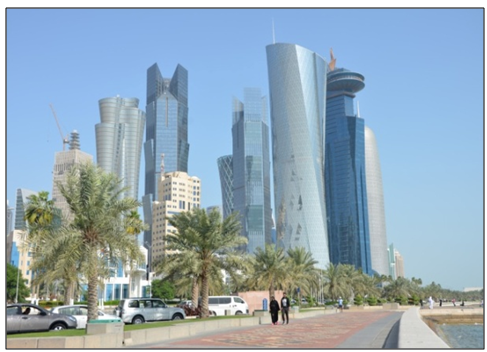
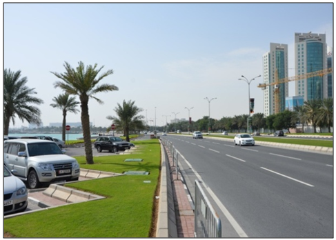
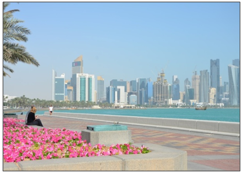
The findings, providing rules of thumb that can be applied for implementing livability within the Corniche area, are structured into six categories: accessibility, landscape, car parking, seating and shelter, comfort facilities and entertainment.
Accessibility
All respondents highlighted the need for implementation of accessibility along the Corniche. The open public space of the Corniche can be subdivided into 3 focus areas: the North, the South area and the pedestrian spine which connects the South to the North area (Fig. 9-10). (1) The North of the Corniche, where the new business district of West Bay is evolving, is surrounded by medium and high-rise buildings. A key feature in this focus area is Sheraton Park, located besides Sheraton Hotel, built in the early 1980s and considered a symbol of Doha. The park defines the northern edge of the Corniche. Pedestrian flow between Doha North residential areas and the new central business district has increased (new high-rise buildings under construction), with pedestrians constantly needing to cross the ring roads. This need requires safe solutions for the accessibility to the North area of the Corniche and for protection of residents crossing the road.
Figure 9. View of the Corniche approaching West Bay
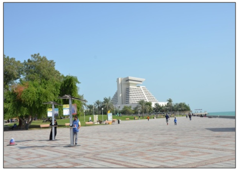
Figure 10. View of Sheraton Hotel from the Corniche
(2) Towards South, the Corniche leads to the Islamic Art Museum, MIA parks and on the opposite side of the museum, to the old traditional area called the Souk Waqif (Fig. 11-12). The general planning policy of locating government facilities and the Al Corniche road parallel to the waterfront inhibits once again pedestrian movement originating from the old centre and the surrounding residential areas. A comfortable walking area should be provided, with a well-planned pedestrian circulation, proper lighting, street furniture and a low noise level.
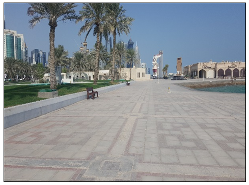
Figure 11. View of the Souq Waqif from the Corniche
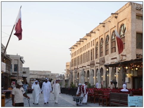
Figure 12. View of one of the entrances to the Souq Waqif
(3) As mentioned, the Corniche is the pedestrian spine of Doha city. Along this spine the user can experience the forming of nodes, of different size and identity. As discussed, the dual carriageway serving as a main artery of the city, the AI Corniche road, provides access to the Corniche but also serves transit traffic passing through the area, forming a fast and straightforward connection between Doha South and Doha North (Fig.13-14). To implement the accessibility to the Corniche along the pedestrian spine, it would be necessary to plan over-and underpasses for pedestrians (pedestrian crosses). This would allow users to have more comfortable and safer access to the nodes along the spine.
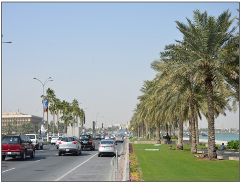
Figure 13. View of the Al Corniche Road towards North
Figure 14. View of the Al Corniche Road towards South
Landscape: Planting and Water Features
The area between the Corniche road and the pedestrian path is landscaped mainly for aesthetical purposes, with the nodal pedestrian areas commonly paved (Fig. 15-16). The north areas delimited by the Sheraton Park and the South one defined by MIA Park are commonly used for picnics, with a playground areas for kids and for various recreational activities.
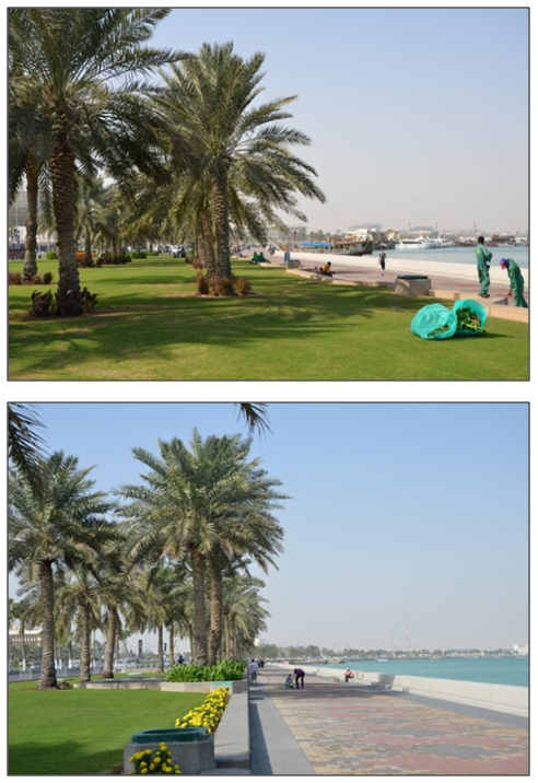
Figure 15-16. Views of the landscaped area between Al Corniche Road and the Corniche
Trees and plants could be combined with palm trees to provide shading. The aesthetics and landscaping along the Corniche, including soft landscape, furniture and lighting should be considered. As far as soft landscaping is concerned, the scarcity of water resources has been mentioned and this should be carefully considered in the design of the environment. Trees are an important feature of landscaping in these climatic conditions but there is a general tendency to use the palm tree, which serves more for its cultural and ornamental value rather than in providing shade. Researchers have shown that the micro-climatological effects are better when palms are planted in combination with shade-giving trees.
The selection of the appropriate surfacing and cladding materials can have a substantial effect on the success of a public space. Vast paved areas such as those in the nodal points do not offer much delight. Soft landscaping (in the form of plants, shrubs and trees), can be a great source of delight, as well as offering health and practical benefits: these areas might also be implemented with well-considered planting offering a more comfortable microclimate and shading and then used for picnics and/or playground areas for kids. In summer, trees can offer shade from bright sunlight and in winter they shed their leaves to maximize the availability of natural light. These natural elements would give a distinctive character and identity to the space.
People generally feel comforted by experiencing natural elements in the landscape. Some of this is sensed visually, but natural elements are also experienced through hearing and touch. Trees rustle and birds sing in the bushes, but perhaps the most vivid and popular sensual experience for humans is that of water. Water can offer a huge soundscape, from drips to babbling brooks to the roar of full-scale waterfalls. Furthermore, water making contact with the skin is one of the most fundamental sensory pleasures, which presumably explains the perennial popularity of splashing and paddling.
Car Parking
There are around 750 parking spaces along the Corniche area (Fig. 17-18-19). Since the Corniche is a narrow strip containing a walkway and a limited green area, it would be not feasible to propose additional parking capacity. It would be more appropriate to provide further parking in neighbouring areas, from which users should be allowed to walk to the Corniche via under or over crossing. Also, other means of public transport to the Corniche area should be encouraged.
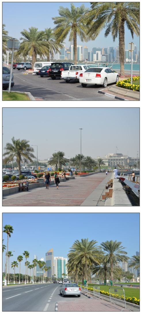
Figure 17-18-19. Views of car-parking facilities along the Corniche
Seating and Shelter (Sun Shading Devices)
The single most important provision to ensure a successful public space is a sufficient range of opportunities for sitting. In many cases, the best seating does not actually consist of custom-designed benches or chairs, rather horizontal surfaces that serve multiple functions. The Corniche is characterised by broad steps, which make an ideal grandstand-seating and offer some kind of sight (Fig. 20).
Figure 20. The edge of the walk ways (edge of flowerbed)
The main sitting area along the Corniche is the edge of the shore that is overlooking the sea and the reason is that people like to observe the sea and relax (Fig 21). Some other individuals prefer to sit on the edge of the walk ways. More seating areas need to be at least partially protected from the wind and namely bright sunshine (Fig. 22-23).
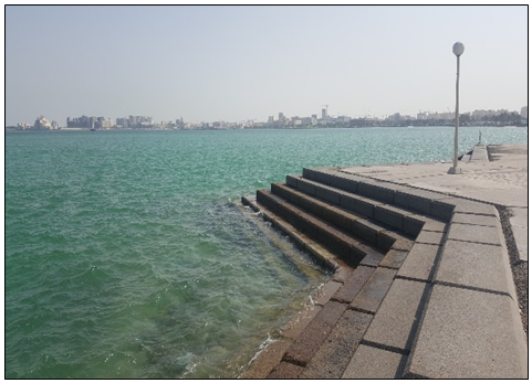
Figure 21. The edge of the shore
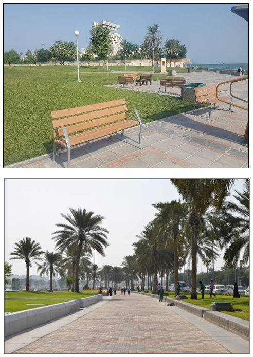
Figure 22-23. View of unshaded seating benches and areas along the Corniche
Comfort Facilities and Entertainment
Many respondents highlighted the need of adequate provision of suitable public toilets, which is part of the fundamental infrastructure for successful public spaces. Inadequate or not sufficient toilet provision, namely along the Corniche spine has a particularly discriminatory effect against older people, those with children and people with disabilities.
Food and drink outlets can also make public space more comfortable and livable. These can range from cafes and bars with outside tables to portable refreshment kiosks where people can get takeaways to be consumed in adjacent sitting areas. In turn, there should be suitable places for picnics, for example within the nodal points along the Corniche (Fig. 24-25).
Figure 24-25. Views of nodal areas along the Corniche
Namely on weekends, a great number of people gather at the Lebanese restaurant and at Costa Cafe’, hosting outdoor seating areas directly in front of the sea (Fig. 26-27). The restaurant and café’ area are the most used and occupied area by families especially during the weekends. Families consider those areas as a gathering point in which they can sit together.
Figure 26. View of the Lebanese Restaurant
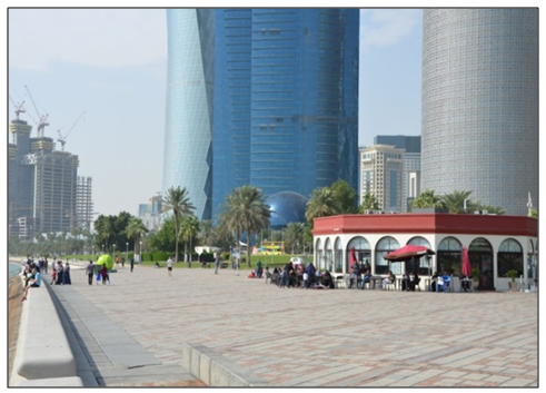
Figure 27. View of Costa Café’ in proximity of Sheraton Park
As highlighted by respondents, a pedestrian network entertainment can also contribute to make the open space more attractive. This can consist of formal events such as festivals and bandstand concerts, or simply through the enabling of entertaining and informal events.

4. Conclusions

What are cities, built, without the wisdom of its citizens (Bertolt Brecht, 1953, cited in 59).
Researchers argue that in the last two decades practitioners, planners and policymakers have neglected the investigation of (A) the relationship between the public realm and social livability and (B) how to implement the current theories on what makes places vibrant and popular by exploring at how people use such spaces.
Many cities are in critical need of economic, physical urban and architectural renewal, therefore it is argued that communities should take advantage of public and private initiatives to preserve and revitalize open spaces. Open spaces can help restraining scattered development, protect natural habitat, preserve cultural and historic settings, and finally provide differentiated recreational opportunities. Practitioners should place emphasis upon the creation of open spaces along the built environment of cities.
Effective urban public spaces (plazas and pocket-parks) are considered crucial to health, happiness and even to the urban economy of cities. They are a true mark of civilization [60]. Urban studies highlight that far too often, new open spaces become underused, misused or abandoned and on the other hand many older squares and urban public spaces are more popular than newly designed ones. Scholars aim at investigating the extent to which it is possible to transform abandoned or leftover urban spaces into vibrant, safe and healing environments, how to improve the quality of particular urban sites, and namely how to alter the design, management and animation of existing spaces to make them more ‘livable’, popular and welcoming to the users [61]. Also, scholars argue that many convivial spaces seem to have grown organically through an accumulation of adaptations and additions to the urban fabric of cities and have not necessarily been designed at the drawing board [62, 63]. Unquestionably there is a need to learn about how plants and natural environments grow, evolve and adapt to local circumstances, how successful open spaces have been formed in the past within the built environment of cities and then mirror this knowledge into the further design, plan and development of the contemporary built environment.
Globalization has become, within the last few years, a catch phrase usually mentioned in a negative context and linked to the end of the twentieth century and the beginning of the twenty-first. In architecture and urban design it is typically associated with a loss of place, identity, and character. Cities throughout the world are becoming shapeless entities with a haunting sameness. It is in Third World metropolitan areas where this ‘universalization’ acquires greater urgency since it is associated with Western hegemony [59].
Nowadays, the world widely diffused need or wish of societies to be ‘globalized’ is based on accepting the imposition of uniform values and beliefs, which do not belong to a single culture, group of people and/or single place: this trend is also leading to a loss of identity/heritage of the built and natural environment of cities. Scholars argue that the design and planning of a city should support the development of the built environment in harmony with the public space and namely a ‘system of urban green’ integrated within the built environment. Despite this argument, the last few decades’ economic prosperity and the resulting significant growth of the population have contributed to develop the built environment without giving sufficient and/or adequate consideration to the shape and function of the city’s public realm and/or open spaces. Regional and urban planning strategies has supported the development of planning instruments taking into account buildings development without considering the equal parallel growth of the open space and in particular the "system of urban greenery" able to balance the effects of built environment. This lack of consideration affects the overall quality of public and private open spaces and therefore the life of the inhabitants/users.
As a result, this worldwide globalized strategy turned cities into anonymous places where the population did not have spaces and services providing a harmonious and sustainable lifestyle. Only lately, due to the growing and needed attention to the environmental or sustainability aspects of cities, practitioners, policymakers and developers have attempted to plan and develop a ‘green system’ through research and identification of land plots which escaped the building process. But these green spaces are in most cases disconnected, not linked, laid on the built environment as individual and fragmented episodes. Scholars argue that advanced studies on environmental issues and landscape and in particular on Landscape Ecology have shown that a designed and implemented, continuous and connected, system of open spaces and/or urban green, considering the landscape as a system of natural and managed ecosystems interacting with each other, contribute to make cities more livable. Almost as if a ‘plot of open space permeated with green’ might be the ‘matrix’, the ‘connective tissue’ through which the development of the new city is organized [64].
As mentioned earlier, the capital city of Qatar, Doha, is going through a rapid urban development. Doha is a rare case, namely in Middle East, of a growing city willing to preserve Qatar’s cultural and heritage identity within the development of its built environment and simultaneously witnessing the development/construction of contemporary and definitely cutting edge infrastructure, neighbourhoods and buildings. The Corniche of Doha is the longest uninterrupted public realm of the city: it is the ‘Urban Majlis’ of Doha, the most significant gathering place, which holds the city together [19]. The challenge for the urban development of the city is now represented by (1) reversing the decline process of its public realm and adopt a strategy which goes beyond beautification of green areas, (2) implementing the Corniche’s physical setting in order to enhance livability, and finally (3) planning an effective system of open green spaces, obviously compatible with the environmental and climate of the place, connected and/or linked to the Corniche. Namely, a planned system of open spaces within the urban fabric of the neighbourhoods of Doha should be studied and critically analysed. Planning strategies and integration projects should be proposed, in order to witness the development of a city where the open, public and green spaces are part of the built environment and contribute to make the city more livable.

5. Future Research Opportunities

Sustainable Urbanism advocates the development of a spatial environment, which would lead to an implementation on lifestyle and/or public health, since it would encourage users to become sedentary and/or obese and deprived of exercise. In relation to future research opportunities, an interesting issue raised during this research study is related to the way and the extent to which the built environment affects health in general and/or how car-oriented, drive-through sprawled communities discourage physical activity and, on the other hand, encourage obesity and other associated health problems. Car-dependent sprawls contribute to social isolation that negatively impacts on inhabitants’ health. Consequently further studies analysing the relationship between social activities and health could be engaged to provide a deep understanding of how the urban fabric of the community can impact on inhabitants’ health.

ACKNOWLEDGEMENTS

The author would like to acknowledge the support of Qatar University for creating an environment that encourages scientific research. This study was developed as part of a research project scheme funded from Qatar University, College of Engineering, Department of Architecture and Urban Planning. Also, the author would like to acknowledge the effort of the contributors in this research study: the dedication and enthusiasm of Architect Sara Awooda and Architect Mariam Shurbaji have been admirable, namely in collecting relevant visual data and cardinal documents for the purpose of this research study. The author would like to take this opportunity to express his gratitude to the Government of Qatar, especially to the Ministry of Municipality and Urban Planning (MMUP), the Qatar National Council for Culture, Arts and Heritage, the Qatar Rail and Ashghal Governmental Agencies of Doha for providing the necessary information and documents. Finally, the authors thank the anonymous reviewers for their constructive comments on the earlier draft. Their observations contributed to an improvement of this paper. The author is solely responsible for the statements made herein.

Appendix

References

[1]  Jaidah I, Bourennane M. The History of Qatari Architecture 1800-1950. Italy: Skira; 2010.
[2]  Kovessy P. Report: Demand for Affordable Housing in Qatar to Remain High in 2015. 2015; 16 February 2015]. Available from:http://dohanews.co/report-demand-affordable-housing-qatar-remain-high-2015/.
[3]  Salama A, editor. The Impact of Economic Diversification on Urban Morphologies in Doha: An Interdisciplinary Assessment. Qatar Foundation Annual Research Forum Proceedings; 2013; Doha.
[4]  Walker L. For first time in five years, Qatar’s population levels off in April. 2015; may 3, 2015]. Available from: http://dohanews.co/for-first-time-in-five-years-qatars-population-levels-off-in-april/.
[5]  Walker L. CMC officials: Qatar needs more affordable high-rise accommodations. 2015; 11 March 2015]. Available from: http://dohanews.co/cmc-officials-qatar-needs-more-affordable-high-rise-accomodations/.
[6]  Salama A, Wiedman F. Demystifying Doha. Uk: Ashgate Publishing Limited; 2013.
[7]  Salama AM. Contemporary Qatari Architecture as an Open Textbook. Archnet-IJAR, International Journal of Architectural Research. 2007;1(3):112.
[8]  Furlan R, Faggion L. The Development of Vital Precincts in Doha: Urban Regeneration and Socio-Cultural Factors. American Journal of Environmental Engineering. 2015; 5(4): 120-9.
[9]  Jodidio P, Halbe R. The New Architecture of Qatar. New York: Skira Rizzoli; 2015.
[10]  Fromherz A. Qatar: A Modern History. Washington, DC: Georgetown University Press; 2012.
[11]  Adham K. Rediscovering the Island: Doha’s urbanity from pearls to spectacle. In: Elsheshtawy Y, editor. The evolving Arab City: tradition, modernity and urban development. Routledge: UK; 2008.
[12]  Rizzo A. Rapid Urban Development and National Master Planning in Arab Gulf Countries. Qatar as a Case Study. Cities. 2014; 39: 50-7.
[13]  Wiedmann F, Mirincheva V, Salama AM. Urban Reconfiguration and Revitalisation: Public Mega Projects in Doha's Historid Centre. Open house international. 38(4): 27-36.
[14]  Bunschoten R. Public Spaces. London: Black Dog Publishing; 2002.
[15]  Carmona M, Tiesdell S, Heath T, Oc T. Public Places Urban Spaces-The Dimension of Urban Design. New York, USA: Routledge; 2010.
[16]  Cervero R. Walk-and-Ride: Factors Influencing Pedestrian Access to Transit. Journal of Public Transportation. 2000; 3(4): 1-23.
[17]  Gehl J. Life Bettween Buildigns: Using Public Space. New York: Van Nostrand Reinhold; 1987.
[18]  Gehl J, Svarre B. How to Study Public Life Washington: Island Press; 2013.
[19]  Furlan R. Liveability and Social Capital in West Bay, the New Business Precinct of Doha. Arts and Social Sciences Journal’. 2015; 6(3): 1-11.
[20]  Brown LJ, Dixon D, Gillham O. Urban Design for an Urban Century-Shaping More Liveable, Equitable, and resilient Cities. New Jersey, USA: John Wiley & Sons; 2014.
[21]  Farr D. Sustainable Urbanism - Urban Design with Nature. United States: Wiley; 2008.
[22]  Givoni B. Urban Design in Different Climates: World Metereological Organization Publication; 1989.
[23]  Handy SL, Boarnet MG, Ewing R, Killingsworth RE. How the Built Environment affects Physical Activity. Views from Urban Planning. American Journal of Preventive Medicine. 2002; 23(2S): 64-73.
[24]  Juppenlatz M. Cities in Transformation: The Urban Squatter Problem of the Developing World. Brisbane: St. Lucia; University of Queensland Press; 1970.
[25]  Kaspirin R. Urban Design-The Composition of Complexity. New York, USA: Routledge 2011.
[26]  Krase J. Italian American Urban Landscapes, Images of Social and Cultural Capital. Italian Americana. 2003; 22(1): 17-44.
[27]  Lang J. Urban Design - A Typology of Procedures and Products. United States: Routledge; 2005.
[28]  Montgomery C. Happy City: Transforming Our Lives Through Urban Design. New York: Farrar, Straus and Giroux; 2013.
[29]  Shaftoe H. Convivial Urban Spaces. Creating Effective Public Places. London: Earthscan; 2008.
[30]  http://www.sustainablesolutionsconsulting.com/. 2015.
[31]  Inglis D. Culture and Everyday Life. New York: Routledge; 2005.
[32]  Giuffre K. Communities and Networks. UK: Polity; 2013.
[33]  Gehl J. Life Between Buildings: Using Public Space. New York: Island Press; 2011.
[34]  Hutchison R, Gottdiener M, Ryan MT. The New Urban Sociology. US: Westview Press; 2014.
[35]  Flanagan WG. Urban Sociology: Images and Structure. New York: Rowman & Littlefield Publishers; 2010.
[36]  Brook D. A History of Future Cities New York: W. W. Norton & Company; 2014.
[37]  Aasen B. Urban Squares. Basel, Switzerland: Birkhauser; 2002.
[38]  S.Abley, Hill E. Designing Living Streets. London: Living Streets,; 2004.
[39]  Bourdieu P. Distinction: A Social Critique of the Judgement of Taste. London: Routledge; 1992.
[40]  Coleman JS. Social Capital in the Creation of Human Capital. American Journal of Sociology. 1988;94:95-120.
[41]  King A. Buildings and Society. Essays on the Social Development of the Buitl Environment. London: Routledge & Kegan Paul; 1984.
[42]  Knowles C, Sweetman P. Picturing the Social Landscape: Visual Methods and the Sociological Imagination. London: Routledge; 2004.
[43]  Leyden KM. Social Capital and the Built Environment: The Importance of Walkable Neighbourhoods. American Journal of Public Health. 2003; 93(9): 1546-51.
[44]  Lucas K. Transport and Social Exclusion: Where are we now? Transport Policy. 2012;20:105-13.
[45]  Alexander C. New Theory of Urban Design. Oxford: Oxford University Press; 1987.
[46]  Gallacher P. Everyday Spaces: The potential of neighbourhood space. London: Thomas Telford; 2005.
[47]  Gunay B. Design Brief for Doha Corniche. Qatar's Centre for Arts & Culture. Ankara: Aga Khan Trust for Culture National Council for Arts and Culture.The State of Qatar, 2003.
[48]  Furlan R, Faggion L. The Souq Waqif Heritage Site in Doha: Spatial Form and Livability. American Journal of Environmental Engineering. 2015;5(5):146-60.
[49]  Furlan R, Almohannad M, Zaina S, Zaina S. Integrated Approach for the Improvement of Human Comfort in the Public Realm: The Case of the Corniche, the Linear Urban Link of Doha. American Journal of Sociological Research. 2015; 5(3): 89-100.
[50]  Zeisel J. Social Science Frontiers.Sociology and Architectural Design. New York: Russell Sage Foundation; 1975.
[51]  Zeisel J. Inquiry by Design: Tools for Environment- Behaviour Research. Cambridge: Cambridge University Press; 1984.
[52]  Creswell J. Research Design: Qualitative, Quantitative and Mixed Methods Approaches. 2 ed. Thousand Oaks, California: Sage Publications; 2003.
[53]  Creswell J. Research Design, Qualitative and Quantitative Approaches. Thousand Oaks, California: Sage Publications; 1994.
[54]  Rapoport A. Systems of Activities and Systems of Settings. In: Kent S, editor. Domestic Architecture and the Use of Space: an Interdisciplinary Cross-cultural Study. Cambridge: Cambridge Univeristy Press; 1997. p. 9-20.
[55]  Rapoport A. The Meaning of the Built Environment: A Nonverbal Communication Approach. Beverly Hills, California: Sage Publications; 1982.
[56]  Rapoport A. Housing and Identity. Cross-Cultural Perspectives. New York: Holmes & Meier Publishers; 1982.
[57]  Rapoport A. House, Form and Culture. New Jersey: Prentice-Hall; 1969.
[58]  Rapoport A. Culture and built form: a reconsideration. In: Moore KD, editor. Culture - Meaning - Architecture: Critical Reflections on the Work of Amos Rapoport. Brookfield: Ashgate Publishing Company; 2000.
[59]  Elsheshtawy Y. Planning Middle Eastern Cities. An urban kaleidoscope in a globalizing world. London: Routledge; 2004.
[60]  Benninson AK, Gascoigne AL. Cities in the Pre-Modent Islamic World - The Urban Impact of Religion, State and Society. US: Routledge; 2007.
[61]  AlSayyad N. Cities and Caliphs: On the Genesis of Arab Muslim Urbanism. US: Greenwood Press; 1991.
[62]  Rudofsky B. Architecture Without Architects: A Short Introduction to Non-Pedigreed Architecture. New Mexico: University of New Mexico Press; 1987.
[63]  Alexander C. The Timeless Way of Building. Oxford, UK: Oxford University Press; 1979.
[64]  Lunardini G.http://worldlandscapearchitect.com/a-private-park-in-tuscany-versilia-italy-giuseppe-lunardini-landscape-architect/#more-20028. 2015.